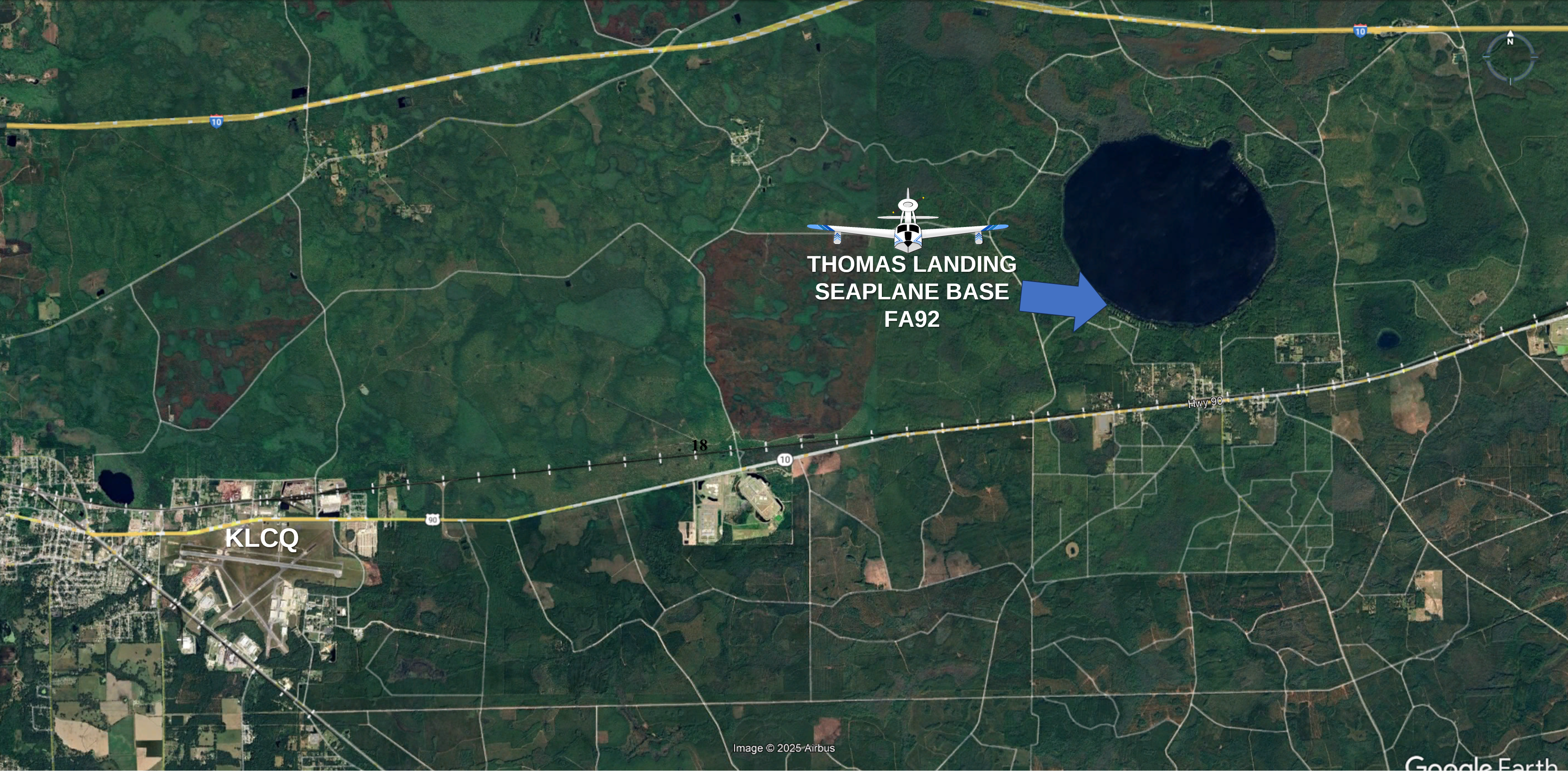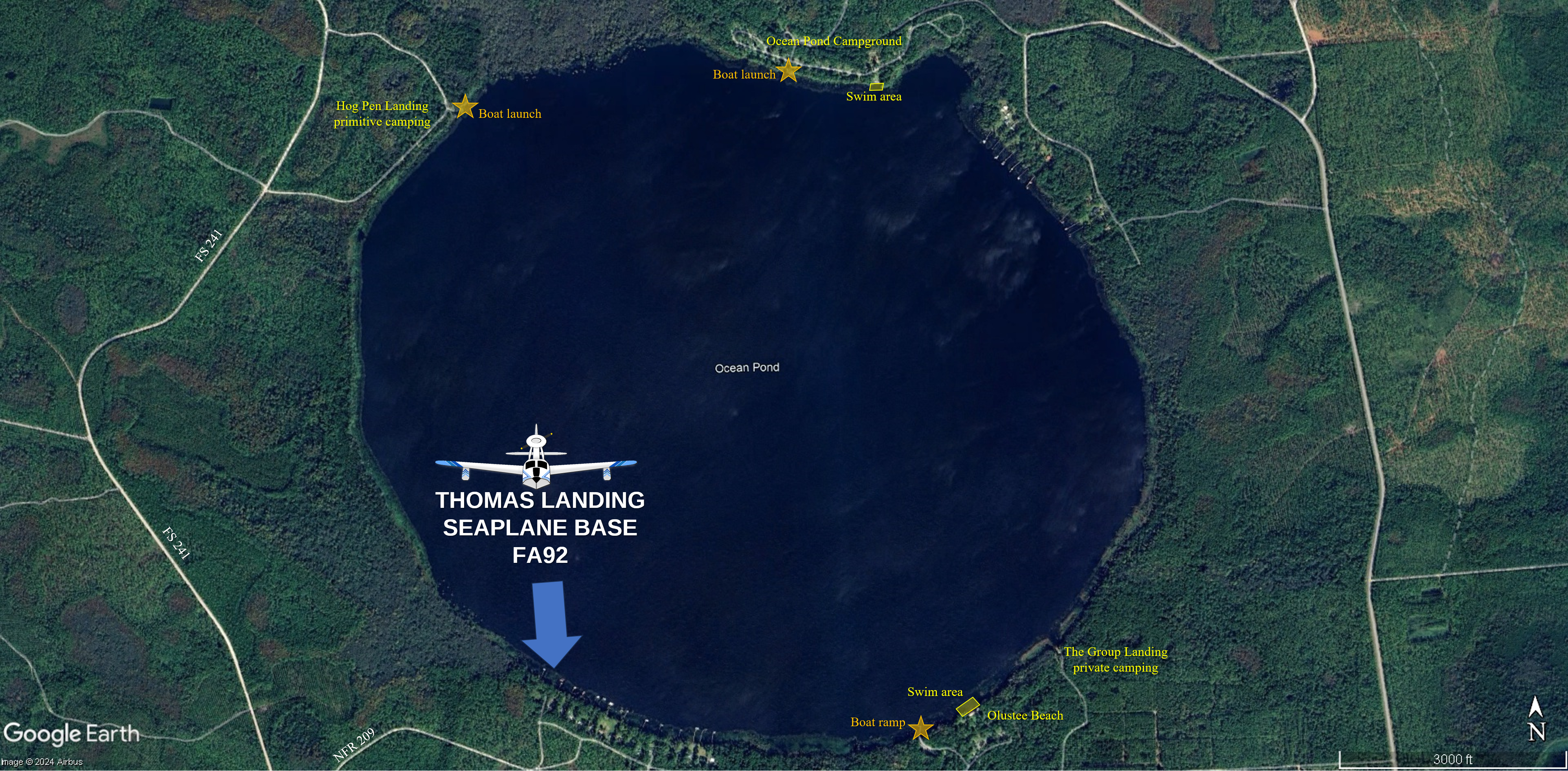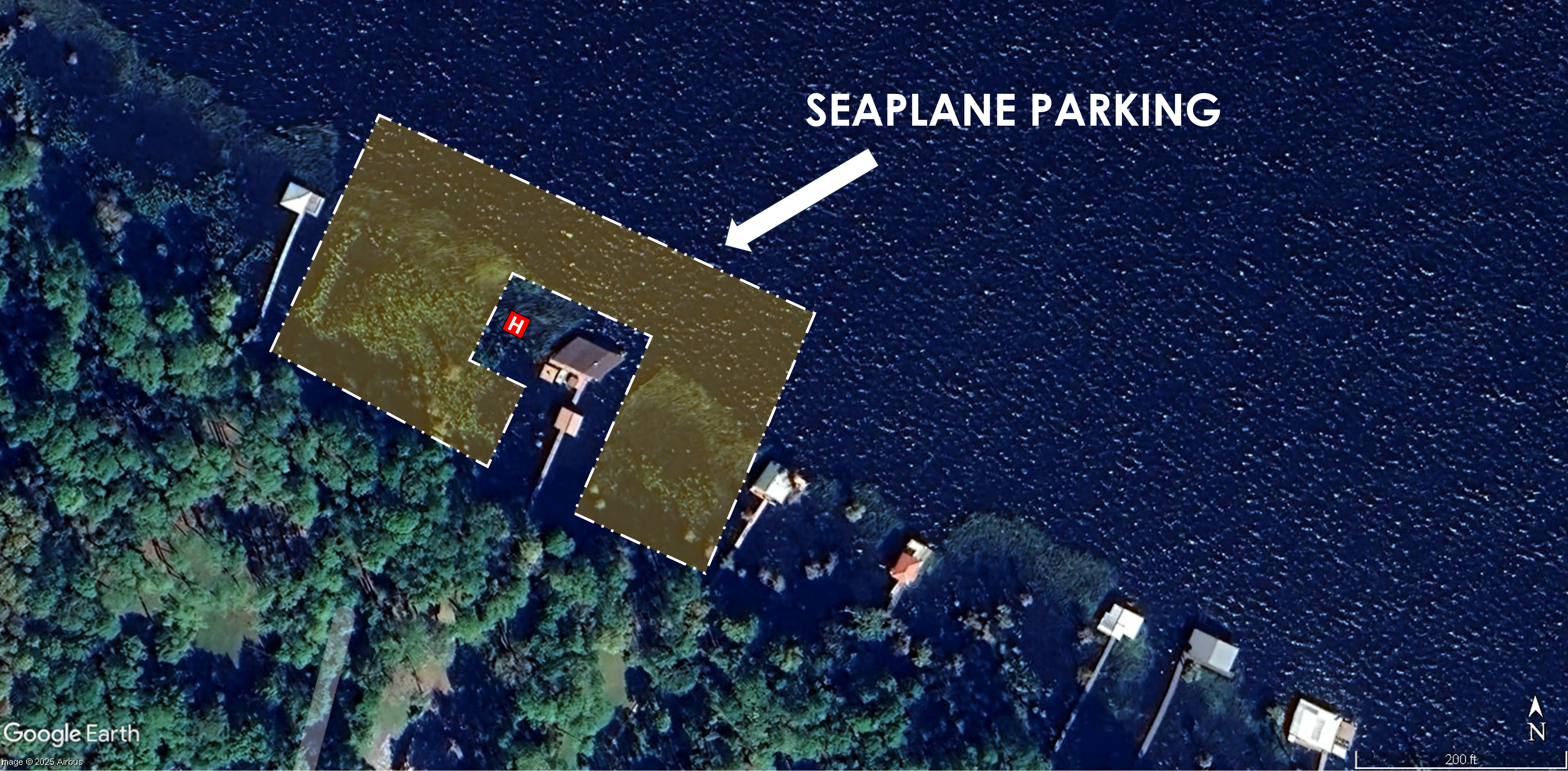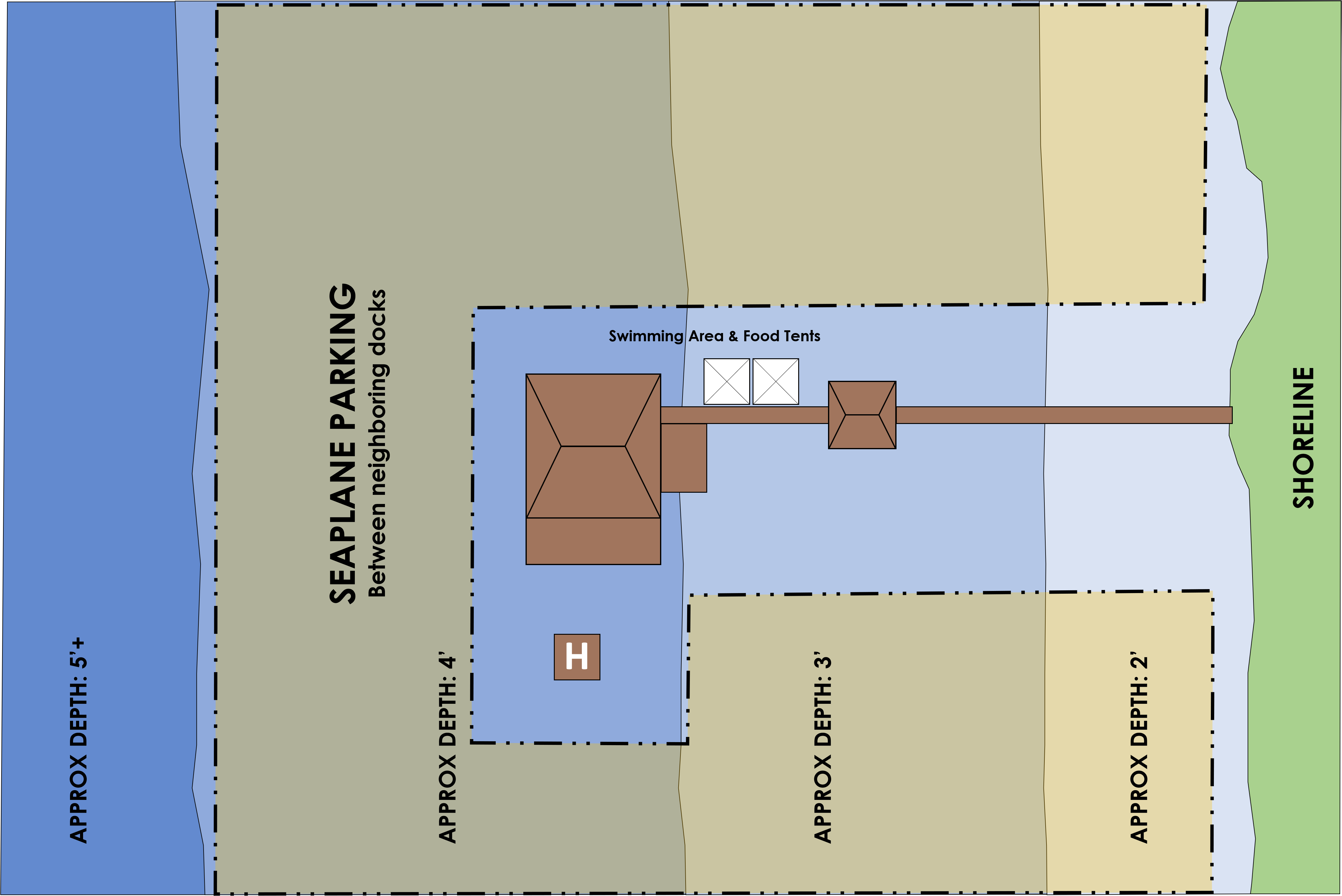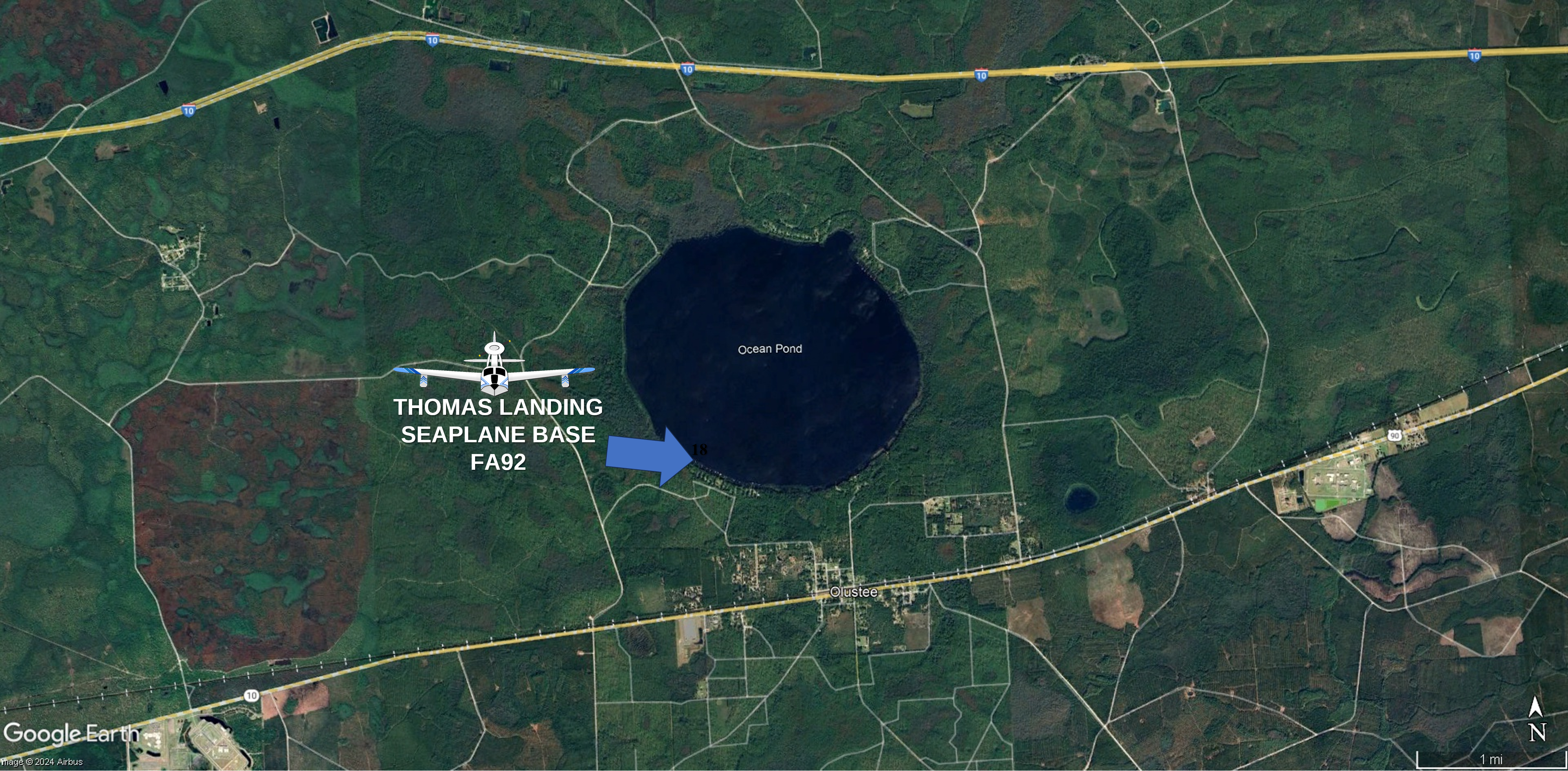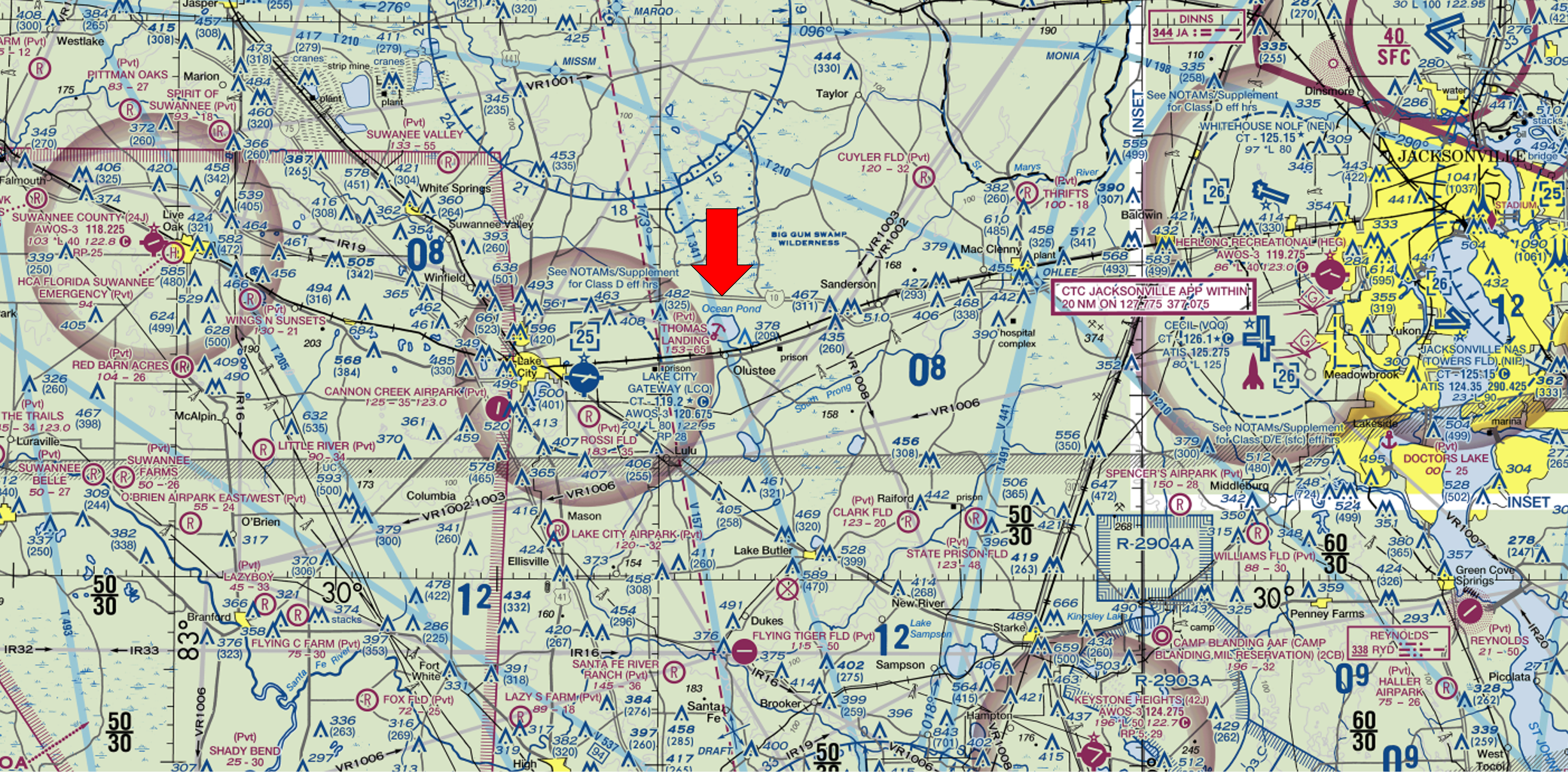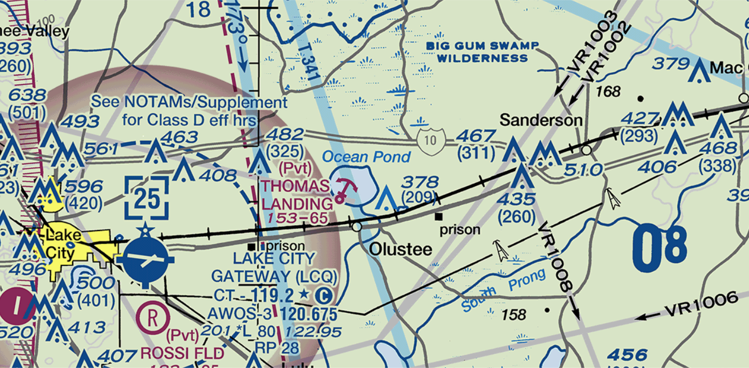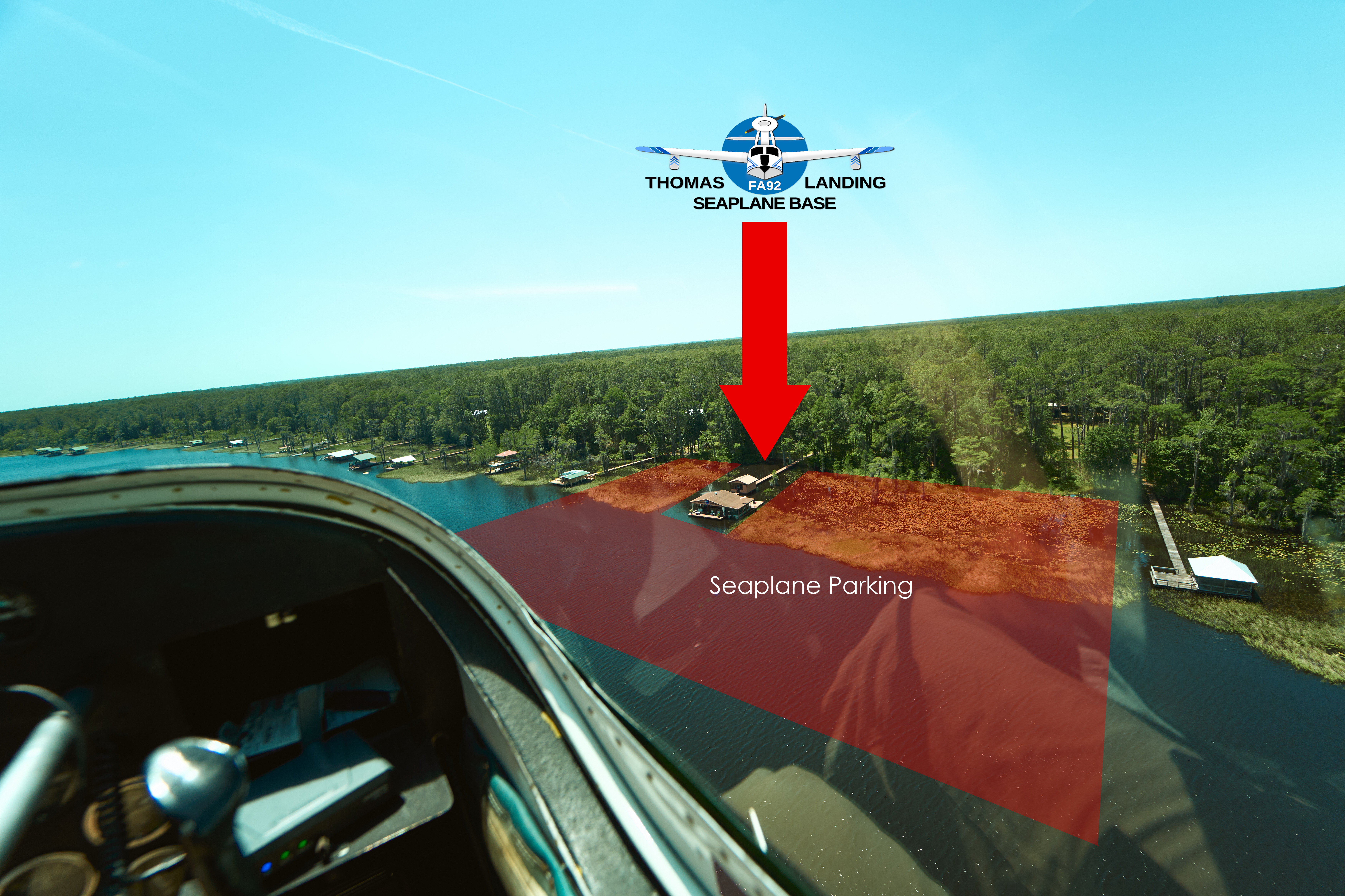

Location
| FAA Indicator: | FA92 |
| Lat/Long: | 30-13-00.7000N 082-26-41.1000W 30-13.011667N 082-26.685000W 30.2168611,-82.4447500 (estimated) |
| Elevation: | 153 |
| Variation: | 03W |
| From City: | 12 miles E of LAKE CITY, FL 7 miles E of KLCQ |
| Time Zone: | UTC -5 (UTC -4 during Daylight Saving Time) |
| Zip Code: | 32072 |
Seaplane Base Operations
| FAA Airport use: | Private use. Permission required prior to landing |
| Control Tower: | No |
| ARTCC: | JACKSONVILLE CENTER |
| FSS: | GAINESVILLE FLIGHT SERVICE STATION |
| Wind Indicator: | Yes |
| Segmented Circle: | No |
Seaplane Base Communications
| WX AWOS-3 at KLCQ: | 120.675 (386-754-9366) |
| CTAF at Thomas Landing: | 122.90 |
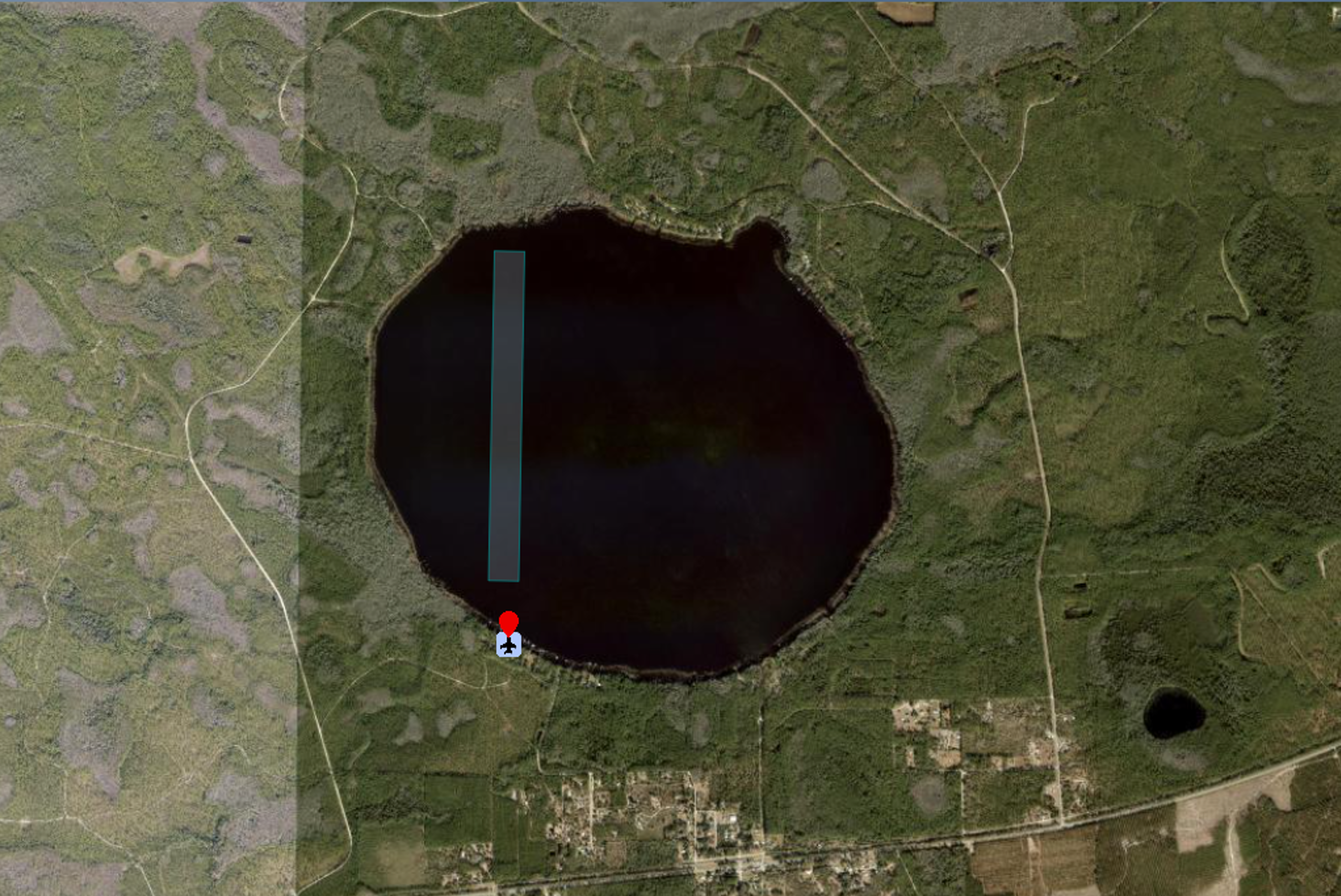
Runway Information
| Runway 18W/36W Dimensions: | 6500 x 600 ft. |
| Surface: | Water |
| Traffic Pattern: | Runway 18W 30-14.257440N 082-26.682788W Right Runway 36W 30-13.185300N 082-26.704620W Left |